Hoo boy, has it ever been a long time since I posted on this blog. There's far too much of my life to explain in just one post, but put briefly, in the year or so since my last post I:
• Moved to the province of Sorsogon to do my Fulbright research;
• Finished my Fulbright research;
• Got a new job as soon as my Fulbright finished; and
• Moved to Davao City (also in the Philippines).
I haven't been living in Sorsogon for about seven months now, but I still consider it my main "home" in the Philippines- it's where I was most able to get to know the people and the geography, and it's where I still have the most friends and acquaintances. It also doesn't hurt that I, uh, met my girlfriend Nikki there. So, I try and go back there whenever I have the chance (which unfortunately isn't very often), and the holidays were the perfect opportunity. Most of the holiday was spent mostly around Sorsogon City (the provincial capital and only city), but just before New Year's we decided to take a quick trip to Bulusan Volcano and Biri Island, two of my favorite places in the Sorsogon area. Since I've been to both of those places before, and I've been terribly lazy with posting blog entries (or pictures in general) for the past year or so, I'll be including some pictures I took earlier in 2016 of the area.
We started out the trip with a bus from Sorsogon City to Irosin, a town in central Sorsogon. Sorsogon province is sort of shaped like a clenched hand, with Sorsogon City in the "wrist" area, and Irosin, the only landlocked municipality in the province, right in the midd of of the "fist".
 |
| A map I doodled of the province and its municipalities for reference- I recommend viewing at full size. |
Irosin is located in a pretty area of green rice fields in a flat bowl surrounded by mountains. There are violent reasons behind that, however- the "bowl" is actually the Irosin Caldera, the remnant of a massive volcanic eruption about 40,000 years ago, about 30 times more powerful than Mount Saint Helens in 1980. Volcanic mountains line the rim of the caldera, the most obvious of which is Mount Bulusan, the highest mountain in Sorsogon and one of the most active volcanos in the Philippines. Now, I lived in Sorsogon for 7 months studying natural disasters, and not once during that period was there an eruption, despite them usually happening every couple of months. Naturally, every time I've been back since then the damn thing has erupted.
This time, we were about to arrive in Irosin town when I happened to look out of the window and see an ominous dark cloud on the northern horizon. A double-take and a couple of (unfortunately loud) expletives later, I was grabbing for my camera and taking pictures of the biggest volcanic eruption I've ever seen.
 |
| The ash cloud is more than 2 kilometers high. |
 |
| Viewed from afar it's scary. Viewed zoomed in it looks downright apocalyptic. |
 |
| What Bulusan looks like in quieter times. |
We were, of course, more than a little apprehensive about our plans to spend the night on the slopes of the volcano. However, when we asked the locals they assured us that it was really not a big deal (ah, to live in an area where 2-kilometer high clouds of death aren't a "big deal"), and that the wind was blowing in the opposite direction so there was no problem. Despite being very obviously active, Mount Bulusan isn't considered to be quite as dangerous as other volcanos in the Philippines for two reasons: first, it has mostly phreatic eruptions, meaning that its eruptions are a result of magma interacting with water. That means that a lot of ash comes out, but there's no lava, and the ash is light enough not to create many huge pyroclastic clouds. Second, it has a sort of "stepped" shape, meaning that most ash is caught on the upper slopes and doesn't slide straight down onto villages below. Nonetheless, the ash can cause sickness in communities that are downwind from the volcano, and there's always the danger of lahars- mudslides caused by a buildup of volcanic ash and a lot of rain.
After ascertaining we weren't likely to die in a cloud of volcanic hellfire, we hired a tricycle to take us to the place I wanted to stay overnight. Jeepneys are difficult to find in that area, so the best way to get around is to find a tricycle driver who will pick you up and drop you off wherever you want to go. Thankfully our driver, who had the unfortunate nickname of Gags, was more than willing to be our chauffeur while we were in the area. After stopping in at Bulusan Lake, our destination for the next day, to reserve an early-morning guide, we checked in at the Balay Buhay sa Uma, where we would spent the night.
 |
| Another rough map of our trip- best to view in full size, especially because of my bad handwriting! |
The Balay Buhay (its full name roughly translates to "House of Life on the Farm" in Bikol) started out as a bee farm before morphing into a small resort more recently. The founder, who I met my first time there, grew up in poverty in Irosin, but managed to get into University of the Philippines Los Baños, one of the best universities in the country, where she got a degree in agriculture and got into apiculture (bee husbandry). She's since become one of the leading experts on raising Philippine stingless bees, and frequently travels to conferences and conventions on apiculture. Since it's meant for bees, the Balay Buhay is absolutely full of flowers of all different kinds, and feels a little bit like paradise- albeit paradise with a view of hell when the volcano is erupting.
 |
| The pool as wonderfully clear- and bone-chillingly cold- water. |
 |
| The stream going into the pool |
 |
| What the bees look like- they're much smaller than honeybees, and stingless. Apparently they're also not quite as productive when it comes to honey, which is why they're not as well-known. |
 |
| Flaming Sunbird, an uncommon bird I saw on my last visit. |
 |
| Paradise with a view of Hell indeed. |
 |
| Four hours after the big eruption and it's still angry. |
 |
| Gif I made of steam coming from the mountain. |
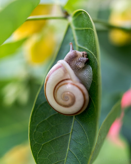
I reserved dinner for us before arriving, which ended up being somewhat more expensive than I expected ($14 for a three-course meal for two is expensive in the Philippines! Especially if you're making a Philippines-level salary like us). Thankfully it was also delicious- soup, a big tilapia, and a new dish for me: snails cooked Bicol express style (in shrimp paste with coconut milk and chili peppers).
 |
| ...yum? |
It actually tasted surprisingly good, but the only problem was that the meat was still inside the snail shells- meaning that you had to suck it out like the shell was a straw. Sometimes the body was stuck so deep inside the shell that it couldn't be dislodged no matter how hard you inhale- which, by the way, leads to some very flattering faces. I was thankful there was nobody else watching us try to eat it.
The next morning, we woke up at 5:30 AM to head to Bulusan Lake for birdwatching, something that's been on my bucket list practically since I moved to Sorsogon. Sorsogon is rare in the Philippines in that it still has large stretches of primary (or at least advanced secondary) forest. That's due to a mixture of factors- first, it's relatively poor, meaning that big industries and agribusinesses don't have as much of a foothold. Second, the population is relatively environmentally conscious, and there have been popular protests against planned infrastructure projects that would require deforestation. And third, there's still a fairly powerful communist rebel in the province, which takes shelter in the mountainous upland areas and demands hefty "revolutionary taxes" on any company that wants to do business there. I guess having an active volcano around can discourage development around it as well.
The most easily accessible good forest in Sorsogon is on Bulusan Lake, which is also the entry point for Bulusan Volcano National Park (BVNP). The lake itself was formed a few thousand years ago when a lava flow from Bulusan dammed a stream. It's now surrounded by tropical rainforest, and there's a path running around the perimeter. It's also absolutely gorgeous.

It's necessary to get a guide to go around the lake after a huge typhoon devastated the area last Christmas (see my last two blog entries). There are no major hills to go up, but the path around the lake has been broken up by landslides and downed trees, and is slippery and tilted at awkward angles at times- turns out that building a poorly-done concrete walkway around an area with hundreds of volcanic earthquakes per year isn't really a well-thought-out strategy. Of course, we needed a guide anyway, because, though I'm very enthusiastic about birdwatching, I'm still not very good at it. There's one guide at the park who's an expert bird spotter, so we had arranged with him the previous evening to meet us early in the morning at the park entrance- unfortunately for my sleep schedule, the best time for birding is almost always just after sunrise.
Right of the bat, we started out with a fairly rare species- a Luzon Bleeding Heart dove briefly seen walking along the path before flying into the bushes. Unfortunately it was so dark I was unable to get a picture of it, but it was still a major lifer for me. Our next birds were even better- a pair of Philippine Trogons, the bird I had as my target for the area. They're another bird that's endemic to the Philippines and hard to find in most places, since they require true forest. However, there are apparently at least four pairs of them that live around the lake, and are fairly obliging for birders and photographers if you get there at the right time. They also happen to be one of the most beautiful birds in the Philippines.
 |
| Male Philippine Trogon |
The rest of the walk was also extremely rewarding- Brown-breasted Kingfisher, Rufous Night Heron and Grey Heron were hanging around the lake, the latter of which allowed decent pictures to be taken of it. There were a number of bird waves (forest birds tend to come in waves, sort of like depression and disappointing election results), including birds I hadn't seen before like the Philippine Fairy Bluebird, Black-Crowned Forest Babbler, Scale-Feathered Malkoha, and Blue-Headed Fantail. Nikki and I are a good team with birdwatching- she's way better at spotting birds than I am, so she carries around the binoculars, while I have the camera and the bird guide on my phone.
 |
| Misty morning jungle. |
 |
| Philippine Fairy Bluebird |
 |
| Jungle around the lake. |
 |
| Grey Heron |
 |
| Yellow-Wattled Bulbul |
 |
| Best picture I could get of a Blue-Headed Fantail. If you use your imagination you can tell it has a blue head! *sigh* |
 |
| Black-Crowned Forest Babbler |
 |
| Cool-looking flower along the trail. |
 |
| Grey Wagtail |
 |
| Gif showing how the Wagtail gets its name (apologies for the bad camerawork!) |
 |
| Female Philippine Trogon |
We ended the walk around the lake with a great view of another pair of Philippine Trogon, especially the female. Overall, we saw 23 species of birds in a 2-hour walk. I'm sure we could have seen more if I'd had more time, more gear, and, uh, more talent, but most of the 23 species we did see were very difficult to find in most of the country, so I was very happy with the result. The complete list can be found here, for those who really want to geek out on bird lists.
After we had breakfast at the park headquarters, good old Gags picked us up and brought us back to the Balay Buhay, where we gathered our things, and then back to Irosin town to wait for a bus to Matnog. Sorsogon is the furthest southeast province in Bicol, a twisty peninsula hanging off the southeastern edge of the island of Luzon like a tail. That means that anyone wanting to go by land to other islands further south has to pass through Sorsogon to Matnog port, where a RoRo (Roll-on/Roll-off) ferry transfers buses, cars, and, in rare cases, solo travelers like us to Samar, the island directly south of Luzon (see my earlier map).
Since Biri Island is off the northern edge of Samar, we had hoped to take a bangka (small outrigger boat used for short-distance trips) from Matnog directly to Biri. However, we ended up getting there a little bit too late for the public boat, and since we didn't really feel like shelling out $50 for a private trip, we ended up taking the RoRo across to Allen, the main port in Northern Samar. From Allen, it was another 20-minute tricycle ride across a low peninsula before we got to the town of Lavezares, where we had to take a bangka to Biri Island. The bangka ride ended up being one of the... less fun parts of the trip, as it was fairly wavy, and since we had the privilege of being in the frontmost seat of the boat, we were the first to be splashed by the waves. The boat captain had a tarp for all the passengers to cover themselves up with, but we still ended the trip feeling rather wet and salty.
Once we were finally back on dry land, we set out to try and find a place to stay and something to eat. Biri town is a bit of a weird place; if it weren't for the one tourist attraction, it would be just another out-of-the-way small island community. As it is, it's a weird mixture of developed and remote; the town itself is dotted with expensive-looking mansions and resorts, but there's electricity only from noon to midnight, and there's literally only one place to eat in the entire island (that isn't very good). My first time there, I had a good conversation with some of the locals and found out that all of the big houses and resorts are owned by foreigners- the colonization of the tourist infrastructure is a rant that would take up an entire blog post for me, so I won't get into it here.
 |
| The view from our hotel |
The next morning, we got up bright and early in order to catch the sunrise at the best location. Biri is on the tourist radar for one thing only: the rock formations on the north side of the island. Just to the east of the Philippines lies the Philippine Trench, the second-deepest oceanic trench in the world, where the Philippine Sea Plate is subducting underneath the Eurasian Plate. It's responsible for the volcanos and earthquakes that make the country an extra-interesting place to live, and in this particular case also uplifted some huge blocks of sedimentary rock from the ocean floor up to the surface. They're made of tough, erosion-resistant minerals (though I'm not good enough at geology to be able to tell you which one it is) that now protect the rest of the island from the furious waves of the Pacific Ocean. The result is some beautiful, otherworldly rock formations that look like something out of California (or sometimes Scotland) rather than the rest of the Philippines.

Getting there meant a 15-minute motorcycle ride, then wading across a large but mostly shallow lagoon in order to reach the rock formations themselves (actually separate islands except maybe during very low tides). This was especially fun before sunrise, when we only had our phone flashlights and the pre-dawn light to see where we were going and avoid slippery rocks. Nonetheless, the sunrise was worth it, as was the otherworldly view across the coast.
 |
| My favorite person! |
 |
| Sometimes the big picture can distract from the equally beautiful details. |
Unfortunately, clouds and intermittent rain meant that the light wasn't quite as spectacular as it sometimes is. I had been hoping for a similar sight to what I had seen my last time there, but alas, it wasn't quite as stunning. Thankfully, since I was incredibly lazy last time and didn't post a blog entry, here are some pictures from back then:
Of course, as long as I was there I did take the time to do a little casual birdwatching. I saw a
Brown Booby (don't laugh, it's an actual bird) flying off the coast, a first for me, and the usual shorebirds, including a
Grey Plover, which at the time was another first (though I've seen about 500 of them since then).
 |
| Grey-tailed Tattlers |
 |
| Common Sandpiper |
 |
| Grey Plover |
We had been relatively lucky on the way there, and arrived at low tide, meaning we had to walk through water only a foot deep at most. Unfortunately, by the time we moved back from the rock formations, the tide had come in significantly, meaning we were walking through water almost waist high (well, waist high for Nikki, more like knee high for me). We didn't have good water shoes or a change of clothes with us of course, because that would have made far too much sense.
 |
| Young mangroves on the way to another viewpoint |
 |
| I always say I grew up on the beach (which is true- Lake Michigan's pretty big after all!). However, there's nothing like standing on the edge of the Pacific Ocean with only a few small islands between you and Central America to make you appreciate the true power of water. |
 |
| Another viewpoint- the rocks we were on top of for sunrise are visible in the distance. |
 |
| Huge dead sea snake we saw |
 |
| What it would have looked like while alive- they're highly venomous! |
 |
| Geological marvels. |
 |
| Pacific Reef Heron |
Eventually we decided it was time to head back to Sorsogon in time for the New Year celebrations, so we returned to our hotel room, once again a little bit wet and salty (but maybe in a good way?), and packed for the return journey. One of the wonderful things about living in Sorsogon (that I didn't appreciate until I left) is how easy it is to travel to other islands and places, since it's right in the middle of the Philippines. One of the many reasons I hope to return to my first Filipino home.
 |
| Very recent shipwreck we passed on the way back. I'm a huge fan of the "well, shit" pose of the guy on the left. |
 |
| Weird statue just outside of Lavezares. Maybe to prevent wrecks like the one we just saw? |


Really interesting and beautiful photography! Am a friend of Kevin Sharp's and so glad he pointed me at your blog!
ReplyDeleteThanks Leslie! Glad you liked the blog! Will try to keep updating.
Delete